

Here are the most shareable cloud facts to use in a lesson or conversation right now.
- Clouds can weigh around 500 tonnes (that is roughly the weight of 100 elephants, yet they still float).
- Clouds form when water vapour condenses onto tiny particles (dust, pollen, and even bacteria act as seeds for droplets).
- White clouds scatter sunlight evenly; dark clouds block it (the thicker the cloud, the less light gets through).
- The highest clouds reach about 60,000 metres (noctilucent clouds sit in the mesosphere, far above normal weather).
- Around 67% of Earth’s surface is covered by cloud at any one time (according to NASA estimates cited by the Met Office).
- Luke Howard gave clouds their Latin names in 1803 (cirrus, cumulus, and stratus are still the root words today).
- Mammatus clouds hang in pouches beneath a storm (they look like a bubble-wrap ceiling and signal severe weather nearby).
- Clouds exist on other planets (Venus has sulphuric acid clouds; Jupiter’s Great Red Spot is a storm system with cloud layers).
- Virga is rain that never reaches the ground (the precipitation evaporates in dry air before it lands).
- Asperitas became an officially recognised cloud type in 2017 (the Cloud Appreciation Society proposed it and the WMO accepted it).
- Green-tinged storm clouds often carry large hail (the colour comes from the interaction of red sunset light and the blue of ice).
- Cloud cover is measured in oktas, on a scale of 0 to 8 (0 = clear sky; 8 = fully overcast).
Teachers and families: the activities section below has three short experiments you can run outdoors or in a classroom.
Key takeaways
Clouds form when water vapour condenses onto tiny particles, and the type, colour, and behaviour of a cloud tells you a great deal about the weather and atmosphere above you.
| Point | Details |
|---|---|
| Cloud weight surprises most people | An average cumulus cloud weighs approximately 500 tonnes, yet tiny droplets and weak updrafts keep it aloft. |
| Colour signals weather | White means thin and harmless; dark grey means thick and rain-likely; green-tinged storm clouds often carry hail. |
| Luke Howard’s system still works | Cirrus, cumulus, and stratus remain the root words for all cloud names, maintained by the WMO’s International Cloud Atlas. |
| Rare clouds are visible in the UK | Nacreous clouds appear in polar vortex winters; noctilucent clouds are visible on summer nights facing north from Scotland. |
| Thezoofamily supports outdoor learning | Kid-friendly cameras and binoculars from Thezoofamily help children observe and record clouds, with one tree planted per camera sold. |
Table of Contents
- How do clouds actually form?
- Why do clouds look white, grey, or even green?
- How heavy is a cloud, and why doesn’t it fall?
- How clouds are classified: Luke Howard’s system
- Rare and spectacular clouds you can spot in the UK
- What clouds do for weather and climate
- Quick cloud trivia for quizzes and warm-ups
- Three activities to try with children
- Why cloud-watching matters for children
- Gear that helps children look more closely at the sky
- Sources
How do clouds actually form?
Clouds form when moist air rises, cools, and water vapour condenses onto tiny particles called condensation nuclei. Without those particles, droplets struggle to form. The nuclei themselves are surprisingly ordinary: dust, pollen, sea salt, bacteria, and yes, even skin flakes drifting through the air.
The process follows a simple sequence:
Warm, moist air rises → it cools with altitude → water vapour condenses onto nuclei → droplets cluster into a visible cloud.
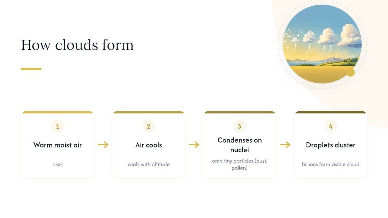
Each droplet is tiny, roughly 0.01 mm across, but billions of them together produce the white mass you see overhead. Clouds are also in constant motion at a microscopic level: new droplets form at the cloud’s top while older ones evaporate at its base, so the cloud you see is never quite the same cloud from one minute to the next.
One dramatic example of cloud formation is the pyrocumulus (or pyrocumulonimbus), a cloud created by the intense heat of a wildfire or volcanic eruption. The heat drives a powerful updraft that carries smoke and moisture high into the atmosphere, forming a storm cloud above the fire. When strong updrafts hit the tropopause, they spread sideways into the distinctive anvil shape of a cumulonimbus. An “overshooting top” pushing above that anvil signals an especially intense storm.
Safety note for classrooms: never attempt to recreate fire-driven clouds. The condensation demo in the activities section uses only a cold surface and warm breath.
Why do clouds look white, grey, or even green?
White clouds scatter sunlight evenly across all wavelengths, which is why they appear bright. As National Geographic explains, this happens because the water droplets inside are small enough to scatter every colour of light in roughly equal amounts, and those colours combine to look white.
Key colour cues to know:
- White: small droplets, thin cloud, sunlight scatters in all directions equally.
- Grey or dark: the cloud is thicker or the droplets are larger, so less light passes through to your eyes.
- Red or orange: low-angle sunlight at sunrise or sunset filters through the atmosphere and tints cloud bases.
- Iridescent (rainbow patches): sunlight diffracts around uniformly sized droplets near the cloud’s edge, producing pastel colours.
- Green-tinged: seen in severe thunderstorms, often linked to large water content or hail; the exact cause is still debated, but it is a recognised warning sign.
Observational tip: if a cloud looks dark, low, and is growing quickly, rain or hail may be close. Stay indoors or under solid shelter during severe storms and never stand in an open field under a cumulonimbus.
How heavy is a cloud, and why doesn’t it fall?
An average cumulus cloud weighs approximately 500 tonnes. That is not a misprint.
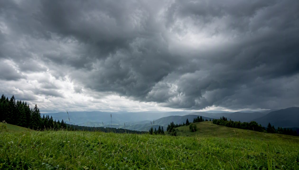
So why doesn’t it drop out of the sky? The answer is droplet size. Each droplet is so small that air resistance and the natural viscosity of air slow its fall to almost nothing. Gentle updrafts, even very weak ones, are enough to keep the droplets suspended. Meanwhile, the cloud is continuously recycling: droplets evaporate at the base and new ones form at the top, so the cloud maintains its position without any single droplet needing to stay aloft for long.
Think of it less like a solid object floating and more like a conveyor belt of tiny water particles, constantly being replaced. The Met Office notes that this dynamic process is what gives clouds their soft, shifting edges.
How clouds are classified: Luke Howard’s system
“Luke Howard’s Latin-based system — cirrus, cumulus, stratus — is the foundation of every cloud name used today.”
Howard, a British amateur meteorologist, published his classification in 1803. The World Meteorological Organization (WMO) now maintains the International Cloud Atlas, the authoritative global reference, but Howard’s three root words remain at its core.
The three Latin families:
- Cirrus (Latin: curl of hair): wispy, high-altitude ice-crystal clouds. Spotted as thin white streaks across a blue sky.
- Cumulus (Latin: heap or pile): the classic puffy, flat-bottomed cloud. Fair-weather cumulus are harmless; cumulonimbus are storm giants.
- Stratus (Latin: layer): flat, sheet-like clouds that cover the sky in a grey blanket and often bring drizzle.
Cloud altitude bands (approximate):
Clouds that span multiple levels, such as cumulonimbus, are classified separately as vertically developed clouds.
Rare and spectacular clouds you can spot in the UK
The most memorable cloud types are the ones that look like they belong in a science-fiction film. Here are the ones worth knowing, with notes on where and when to find them in the British Isles.
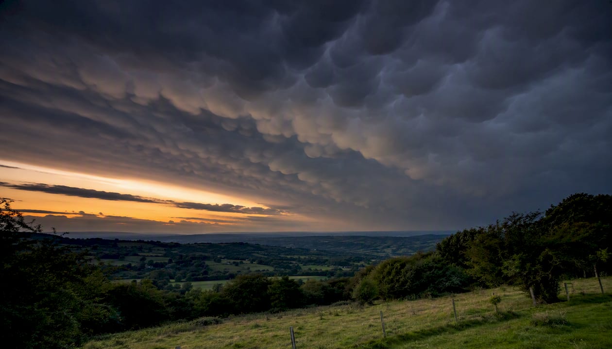
Mammatus clouds hang in rounded pouches beneath the base of a cumulonimbus anvil. They form when cold, moist air sinks into drier air below the cloud. Visually striking, they are also a sign that a severe storm is nearby. The Met Office advises observing them from a safe distance and never approaching the parent storm system.
Lenticular clouds form over hills and mountains when stable, moist air flows over high ground and creates a standing wave. They are lens-shaped or stacked like plates, and they hold their position even in strong winds because the wave itself is stationary. In the UK, look for them over the Scottish Highlands, Snowdonia, or the Peak District on windy days.
Nacreous clouds (also called polar stratospheric clouds) form at altitudes of roughly 15,000–25,000 m when temperatures drop below −78 °C. They display vivid mother-of-pearl iridescence and are visible just after sunset or before sunrise. In the UK, they appear during strong polar vortex events, most often in Scotland and northern England in January or February.
Noctilucent clouds are the highest clouds on Earth, forming at around 60,000 m in the mesosphere. They are only visible in deep twilight, when the sun is below the horizon but still illuminates these very high ice crystals. In the UK, look for them from late May through August, facing north after sunset. Scotland and northern England offer the best views.
Asperitas clouds have a chaotic, wave-like underside that resembles a rough sea viewed from below. The Cloud Appreciation Society proposed the name, and the WMO formally recognised asperitas in 2017, making it the first new cloud type added to the International Cloud Atlas in decades.
Virga appears as streaks or trails falling from a cloud base that fade before reaching the ground. The precipitation, rain or ice crystals, evaporates in the drier air below. Common in summer over the UK’s drier eastern counties.
Arcus clouds (shelf and roll clouds) are low, horizontal bands that form along the leading edge of a thunderstorm’s cold outflow. A shelf cloud stays attached to the parent storm; a roll cloud is detached and tumbles slowly. Both indicate that a storm front is approaching.
Funnel clouds and tubas are rotating columns of cloud that descend from a cumulonimbus. If the funnel reaches the ground over land it becomes a tornado; over water it becomes a waterspout. They are rare in the UK but do occur, particularly in autumn along the south and west coasts.
Safety reminder: photograph all severe-weather cloud types from indoors or a sturdy building. Never stand in open ground near a cumulonimbus.
What clouds do for weather and climate
Clouds act like a mirror and a blanket at the same time, and which effect dominates depends on the cloud type.
- Mirror effect: bright, white clouds reflect incoming sunlight back into space, cooling the surface below. Thick low clouds such as stratocumulus are the most effective reflectors.
- Blanket effect: thin high clouds such as cirrus let sunlight through but trap outgoing heat radiation, warming the surface. This is similar to the greenhouse effect.
- Storm signal: a towering cumulonimbus with an anvil top and an overshooting dome means the updraft has punched through the tropopause. Severe rain, hail, lightning, and strong winds are likely.
- Climate feedbacks: as the planet warms, cloud patterns shift. Whether that produces more cooling or more warming is one of the largest uncertainties in climate science, as OpenClimateFix notes.
A simple classroom comparison: on a clear night, temperatures drop quickly because there is no cloud blanket to hold heat in. On an overcast night, the same location stays noticeably warmer. That single observation demonstrates both effects in one experiment.
Quick cloud trivia for quizzes and warm-ups
How big is a cloud droplet? About 0.01 mm across. A raindrop is roughly 100 times larger.
What fraction of Earth has cloud cover right now? Around 67% of Earth’s surface is covered by cloud at any given moment, based on NASA satellite data.
What are the highest clouds? Noctilucent clouds, at approximately 60,000 m in the mesosphere. Standard weather clouds top out at around 12,000 m.
Do other planets have clouds? Yes. Venus has thick clouds of sulphuric acid droplets. Jupiter and Saturn have ammonia ice clouds. Even Mars has thin water-ice clouds near its poles.
What is cloud seeding? It is the process of releasing particles (often silver iodide) into clouds to encourage precipitation. Several countries use it to increase rainfall or reduce hail damage, though it remains scientifically and politically contentious.
What does 8 oktas mean? A fully overcast sky. The oktas scale runs from 0 (clear) to 8 (complete cloud cover) and is used by meteorologists worldwide.
Three activities to try with children
“Try these three short activities to turn facts into outdoor learning.”
-
Cloud-spotting observation sheet (ages 6–14, 10 minutes outdoors) Print or draw a simple grid with columns for time, cloud shape, colour, and altitude guess. Go outside and record three clouds in five minutes. Back inside, match each description to the cirrus/cumulus/stratus families. For ages 6–8, focus on shape only; for ages 9–14, add the altitude band. The UCAR COMET cloud trivia activity offers a ready-made printable version.
-
Cloud trivia fortune-teller foldable (ages 7–12, 15 minutes) Fold a square of paper into the classic fortune-teller shape. Write cloud names on the outer flaps and facts or quiz questions inside. Children take turns asking questions and lifting flaps to reveal answers. This works well as a starter activity or end-of-lesson review. No materials beyond paper and a pen are needed.
-
Condensation demo (ages 8–14, 5 minutes, indoors) Hold a cold glass or metal tin (filled with ice water) in a warm room. Within a minute, water droplets form on the outside. This is condensation: warm, moist air cools against the cold surface and water vapour turns to liquid, exactly as it does on condensation nuclei in the atmosphere. Safety note: no heat source, no open flames, and no pressure vessels are needed or permitted. Supervise younger children around the cold water.
Classroom differentiation: for ages 6–8, use the fortune-teller and the spotting sheet with shape-only identification. For ages 9–14, add the altitude table from the classification section and ask pupils to estimate cloud height from appearance.
Why cloud-watching matters for children
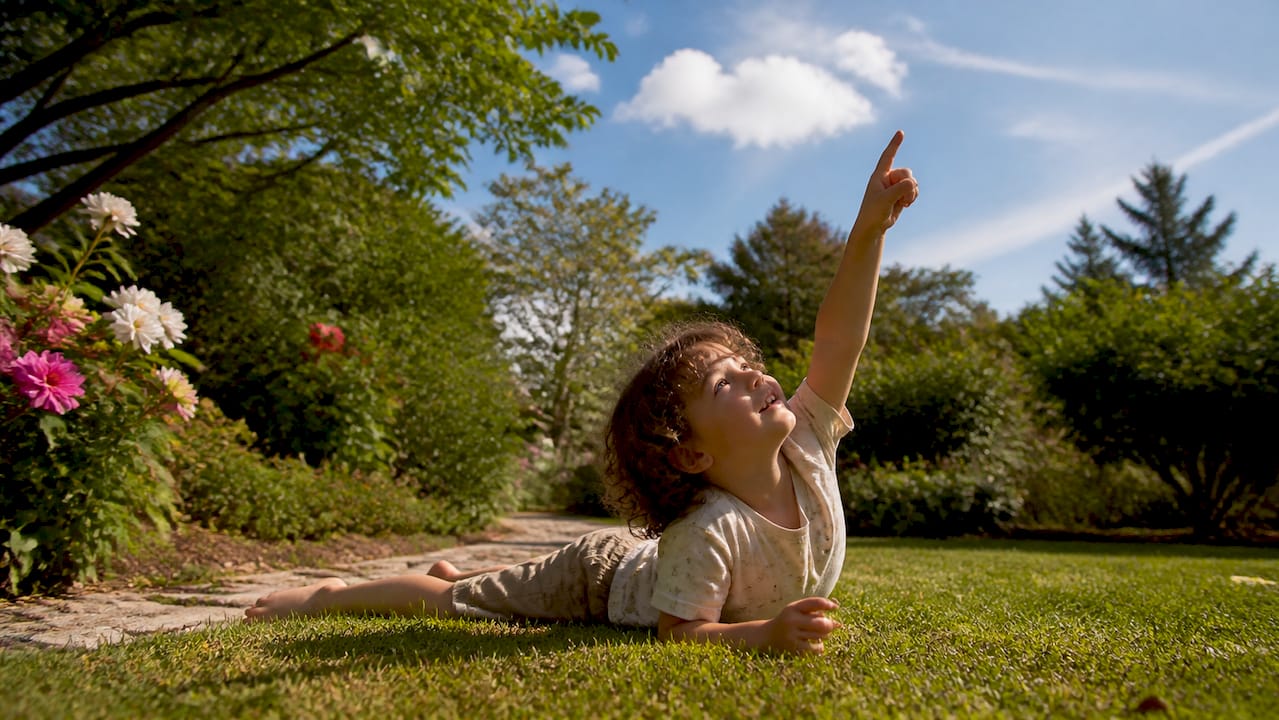
Cloud-watching is one of the simplest ways to get children to look up, slow down, and notice the natural world around them. You do not need equipment or a special location. A garden, a school playground, or a park bench is enough.
At Thezoofamily, the aim is to help children build real connections with nature, not just read about it. The brand’s products, from kid-friendly cameras and binoculars to walkie-talkies, are designed with animal references that prompt curiosity about the outdoors. For every camera sold, Thezoofamily plants one tree, a small, concrete step towards restoring the natural environments children are learning to observe.
Cloud-watching fits that mission directly. A child who learns to identify a lenticular cloud over a hillside, or spots noctilucent clouds on a summer evening, is a child who is paying attention to the planet. That attention is worth encouraging.
Gear that helps children look more closely at the sky
If you want a practical way to help children engage with cloud-spotting, lightweight binoculars or a simple kid-friendly camera can make the experience more engaging and more memorable.
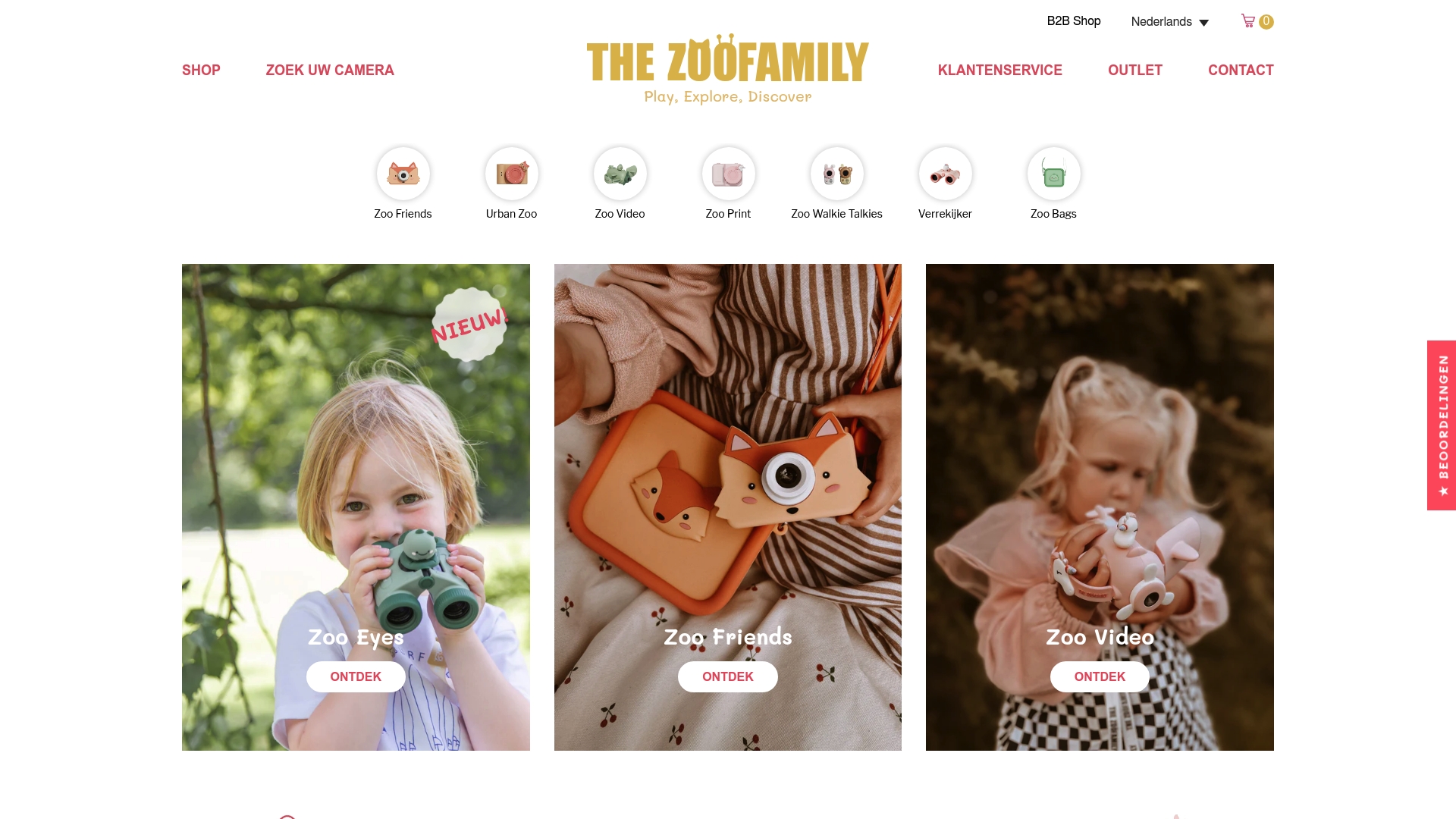
Binoculars let children pick out the fine detail of a lenticular stack or the pouch shapes in mammatus clouds that are hard to see with the naked eye. A pocket camera gives them a record of what they spotted, which reinforces the learning and gives them something to share with classmates. Thezoofamily’s range of children’s outdoor gear is built for small hands, designed with nature-themed references, and backed by the brand’s one-tree-per-camera commitment. Visit thezoofamily.com to see the current range and find the right tool for your child’s next sky-watching session.
Sources
- No fluff here: 10 little known cloud facts
- 7 facts about clouds - Met Office
- Cloud - National Geographic Education
- 10 Surprising Facts About Clouds
- Cloud types and their meaning - Mental Floss
- 8 illuminating facts about clouds | TED Blog